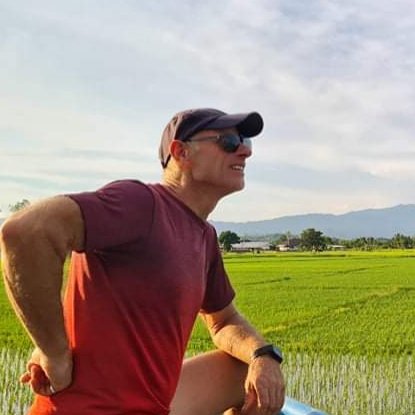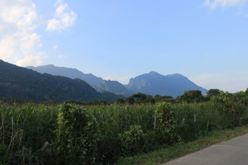
In this article, I’ll show you my favorite motorbike route: a beautiful 65-kilometer ride from Mae Sai via the famous Doi Tung, then back along the border between Myanmar and Thailand.
Most travelers in Thailand get to know Mae Sai when they need to do a visa run across the border into Myanmar. At first glance, this small town is not particularly impressive. The typical drab garage-style architecture of Thai townhouses is broken up only by a few temples and hotels. Apart from a large market selling inexpensive Chinese products and the Doi Wao Temple, which offers beautiful views over the town and into Myanmar from a skywalk, Mae Sai has very little to offer. That’s probably why so few travelers stay for more than a couple of days. However, the surrounding area has many worthwhile places to explore.
So rent a scooter and join me on the Doi Nang Noon Loop.
The ride starts somewhere along the main road, Highway No. 1, possibly even right at the border crossing to Tachileik, as that’s where the loop ends. Head south out of town for about 20 km to Huay Khrai. At first, you’ll pass many roadside stalls selling strawberries, which are grown in the nearby fields during the winter. Farther along, you’ll mostly find delicious pineapples for sale. Stay in the lane designated for slower vehicles such as bicycles and scooters.
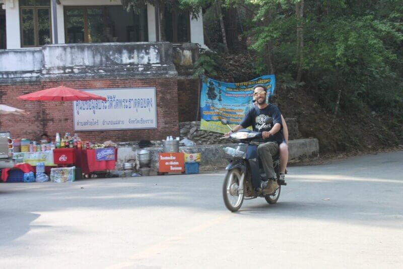
To your right, you have a view of beautiful green mountains. The over 1400-meter-high Doi Nang Noon is the first to stand out. Here, in Tham Luang, the large cave, the drama of the youth soccer team unfolded in 2018. The 13 boys, who called themselves “Mu Pa” (Wild Boars), were rescued by an international team of rescue divers after almost three weeks trapped in a flooded chamber.
The profile of this sleeping woman, around whom an old story is woven, is best seen from Huay Krai. The third peak in the range, Doi Tung, is our first destination. But don’t let the beautiful view distract you too much, as you might encounter someone driving in the opposite direction, since driving in rural Thailand is quite different from Central Europe.
In Huay Khrai, you’ll already see signs for Doi Tung. The large traffic-light intersection is hard to miss. Follow the green road signs and turn right. Just before the intersection, there’s a gas station. Check that you have enough fuel in your tank, as it will be difficult to refuel later on.
Heading Up to Doi Tung
Just a few kilometers after the intersection, the climb begins. Stay on the road as it first passes through a village with a large fruit and vegetable market (at the junction with the police box), then winds through lush vegetation, following the contours of the mountain. The “new” road is excellently maintained so the royal family can comfortably drive up to the Royal Villa. That’s our first destination, although we’ll stop a few kilometers beforehand at a viewpoint with spectacular scenery. On a clear day, you can see across the plains all the way to Laos. It’s also a wonderfully romantic spot to watch the full moon rise. At a few roadside stalls, Akha women from the village on the opposite side of the road sell coffee, fruit, jewelry, and clothing. The village was relocated there during the construction of the Royal Villa to make way for the project.
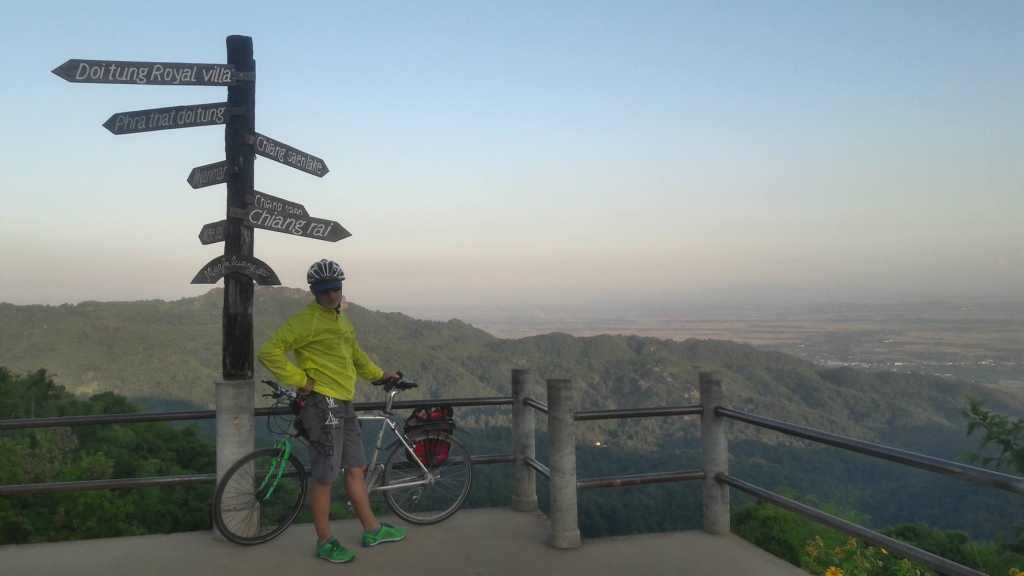
Back on the road, turn left at the intersection a few kilometers ahead toward the Mae Fah Luang Garden and the Royal Villa. If you enjoy botanical gardens and would also like to visit the villa, it’s worth buying a combined ticket. The villa documents the life of the Queen Mother, who, incidentally, gave birth to her second child in Heidelberg, Germany, while studying there. Mae Fah Luang, the “Royal Mother from the Sky,” spent much of her time in the pleasant mountain climate and was especially admired for her charitable work among the local hill tribes. Even more than 20 years after her death, events are still held in her memory. I attended one such event where, every October in recent years, more than 1,000 cyclists rode from Huay Khrai to Doi Tung. The 2015 motto was: “20 years have passed, but we have not forgotten.”
I prefer to enjoy a delicious coffee at the Doi Tung Coffee Shop and watch the many people who come up here. There are only a few farang (Western foreigners), but plenty of Chinese visitors and, above all, Thai tourists. At the parking area, you can browse market stalls selling products from the surrounding hill villages. Most of the nearby mountains are home to the Akha people, an ethnic minority that migrated to Thailand from the Tibetan and southern Chinese regions.
To continue along the Doi Nang Noon Loop, first head back to the intersection where the road to Huay Khrai branches off to the right downhill. This time, turn left. Before the road climbs steeply to the right toward Wat Phra That Doi Tung, you can stop at a viewpoint on the left overlooking the gardens of the Chiang Rai Plant Research Center. You may also notice that the vegetation has changed as you’ve climbed higher. Doi Tung is home to a unique variety of plant life spread across different vegetation zones.
The Meditative Bell Path to Wat Phra That Doi Tung
After a particularly steep section, it’s only a little over one kilometer to the right from the next intersection until you reach a curve where you can park your scooter at the foot of a staircase. (Note: Don’t stop at the first temple immediately after the intersection. Continue a little farther past a steep stretch with fantastic views to the left.) You could ride all the way to the top, but then you’d miss the beautiful Bell Path—and one of the best photo opportunities.
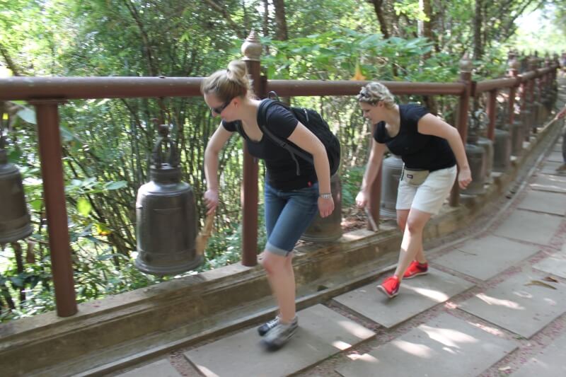
Along the path, you’ll find what feels like at least 100 bells, each of which should be struck with a wooden mallet. According to tradition, doing so brings you a longer life. For me, ringing the bells is a deeply meditative experience. I focus on each individual strike, fully experiencing every sound in the present moment before moving on to the next. By the time I reach the end of the path, I feel refreshed and relaxed—and that surely contributes to a longer life.
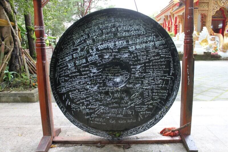
Wat Phra That Doi Tung is home not only to ancient Buddha statues and sacred relics, but also to a stupa that you can walk around three times in a clockwise direction. As a sign of respect for Buddhist customs, be sure to remove your shoes before doing so. One of my favorite features here is the large black gong, which many worshippers have signed over the years. Its deep, resonant sound is truly impressive. Give it a try—but remember to strike the center three times.
The walk to the Doi Tung Viewpoint is especially worthwhile on clear days during the rainy season, when you can see the mountains of Laos and even catch a glimpse of Phu Chi Fa. The view across the plains is also beautiful during the winter months before the burning season begins.
Arboretum – Orchids and Trees
Ride your scooter back to the intersection, then continue straight uphill until you reach the next turnoff to the right toward Mae Sai. The road passes through pine forests and leads to the Arboretum, a park filled with hundreds of orchids and flowering shrubs. Unfortunately, the orchids bloom only once a year.
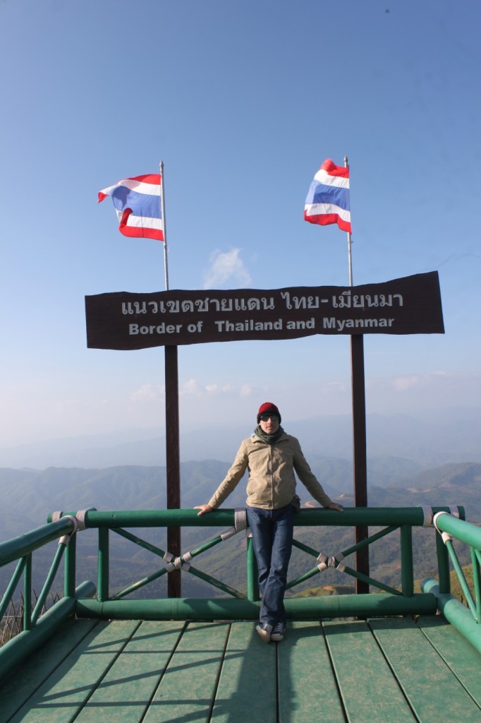
Beyond the Arboretum begins the more adventurous section of the Doi Nang Noon Loop. The road becomes more challenging (so this is a good point to decide whether you’d rather turn back the way you came), but it also becomes more spectacular. The next stop is a Thai military checkpoint. It’s worth stopping here to look around and enjoy the sweeping views across the border into Myanmar.
The soldiers stationed here now spend more time tending the flowers and lawns than watching for enemies or exchanging gunfire. The last armed clashes in this area took place about ten years ago. Today, both countries are members of ASEAN, the Association of Southeast Asian Nations. It is hoped that, in the future, the borders will become more open, similar to those within the European Union.
A little farther down the road, you can see the military post on the Myanmar side. Locals have told me that, in the past, soldiers from both sides would keep watch during the day and then gather around a campfire in the evening to drink lao khao, the local rice whisky.
Enjoy Coffee Where It’s Grown
We continue along the mountain ridge that forms the green border between the two countries. Smuggling still takes place here, with who-knows-what being carried along hidden mountain trails. The road becomes much narrower and steeper, with some tricky bends, so drive carefully and take your time.
On your right, you’ll see the Akha village of Ban Pha Hee. It’s well worth turning right into the village to look around and see how people live here today. In the past, opium was the main source of income; today, it’s coffee. You’ll see large coffee plantations covering the hillsides around the village. Doi Tung coffee is known for its excellent quality and is very popular in Thailand.
The village has also become a popular destination for small tour groups. When I first hiked here in 2014, there was only one café. Now there are seven. In my opinion, the best view is from the rooftop terrace of Phu Phahee Coffee.
If you like to wake up with the extraordinary view on the mountains in the morning dust, consider to stay overnight at
Maan Fah Homestay.
Back on the road to Mae Sai, the next stretch offers stunning panoramic views of the surrounding mountains. On the left, across the border in Myanmar, the large open areas and barren hillsides are especially noticeable. This is partly due to widespread slash-and-burn farming, and partly because much of the charcoal sold in Thailand comes from Myanmar.
This mountain range on the right are the famous Doi Nang Noon – “Mountain of the Sleeping Woman”. Like many mountain regions, it is surrounded by a legend of a princess. However, this mountain became widely known because of its cave, Tham Luang. In 2018, an internationally supported rescue operation saved 13 teenagers from this cave.
On this tour, you’ll also pass two police checkpoints, where the friendly officers usually wave you through after a quick check. If one of them is feeling chatty, you might be asked, “Where do you come from?” It’s easy to strike up a conversation with the young officers if you know a few words of Thai.
A great icebreaker is asking to take a photo with them. Saying “Thai ruup dai mai khrab?” (or “…kha” if you’re female), which means “May I take a photo?”, usually brings a smile and gets everyone happily gathering for the picture.
After the second police checkpoint, it’s all downhill from there. If you turn left at the intersection on the outskirts of Mae Sai, the loop ends at the large daytime market, known as the Burmese Market, right next to the border with Tachileik, the border town in Myanmar. The Chinese goods sold here are transported about 250 kilometers through Myanmar to reach the market.
If you turn right instead, the road leads to the main intersection at the entrance to Mae Sai, where you’ll find the distinctive Bird hotel and the gas station.
In the evening, as the market closes, food stalls begin setting up along the main street just before dusk. Here, you can enjoy many of the dishes Thailand is famous for, from khao pad (fried rice) and guai tiao (noodle soup) to roti, a type of sweet flatbread.
Have fun on the Doi Nang Noon Loop! And let me know how you enjoyed it.
Note:
The roads through the border mountains are steep and can be challenging, although they are fully paved. If you’re riding with a passenger, you’ll definitely need a 125cc scooter, otherwise one of you may have to get off on the steeper sections. You should also have some experience riding a scooter, as this route is not suitable for beginners.
The loop is also suitable for very fit cyclists. If you ride from Mae Sai, you’ll tackle the steeper climbs but be rewarded with the more scenic descent. If you ride from Huay Khrai to Mae Sai instead, take extra care on the steep hairpin bends after the military checkpoint, as there are often small loose stones on the road.
You Might Also Be Interested In:
Find my best tips for Mae Sai, including accommodation recommendations on STEFANinTHAILAND Mae Sai info
All the Attractions in the Area: Trips in Chiang Rai province